Livewell turns 80-page state fish-consumption advisories into a plain-English answer — by water, species and size. Plus what's legal to keep, and when the bite is on. All on your phone, fully offline.
Android today · iOS coming soon
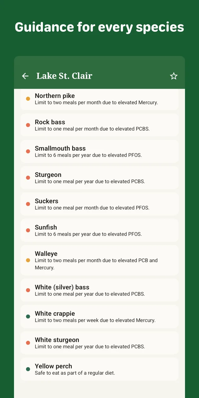
Consumption advisories by water, species and size — for the general population, women of childbearing age, and children. Tap any contaminant (mercury, PFAS, PCBs) for what it means and how to lower your exposure.
Size, slot and daily-bag limits, plus separate catch-and-release and catch-and-keep seasons with live open / closed status — so you know what stays on the stringer.
Solunar best-bite times with a 24-hour activity curve, live NWS weather, an interactive map, and the nearest boat ramps and fishing access.
The hard part isn't the app — it's the resilient, per-state ingestion pipeline behind it, standardizing wildly inconsistent DNR sources into one honest answer.
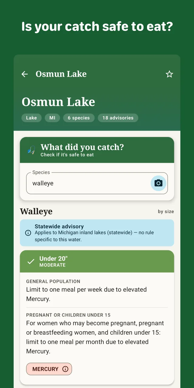
Pick the species and length and Livewell returns the meal advice for every size band and population group — then the harvest rules right below it. Safe-to-eat and legal-to-keep, side by side.
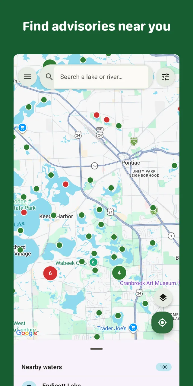
Waters are pinned by advisory status — red where advisories exist, green where none are on file — with boat-ramp, marina and fishing-pier markers when you zoom in. Dark mode follows your theme, and a tap flips to satellite.
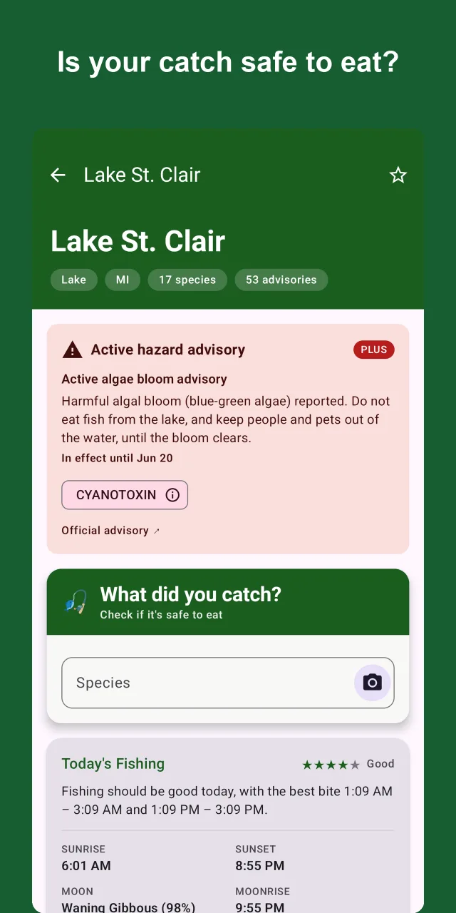
Algae blooms, sewage spills and fresh PFAS advisories are time-sensitive and easy to miss. Livewell pulls live hazards from the National Weather Service and geofences them to your saved spots.
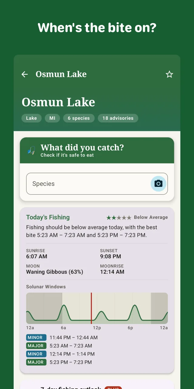
A plain-English fishing summary, sunrise and moon, and a 24-hour solunar activity curve with major and minor windows. A 7-day outlook helps you pick the morning worth the early alarm.
On-device photo identification names your fish and re-ranks the guesses by what's actually caught in your state — so a look-alike doesn't send you to the wrong advisory. Pick a match and the safe-to-eat answer follows.
Every state format is different — PDFs, ArcGIS layers, spreadsheets. We ingest them one at a time and standardize them into a single schema. 50 states live now, and growing:
Livewell Plus adds the time-sensitive, quality-of-life extras. It never sits between you and knowing whether a fish is safe.
Never paywalled: the answer to "can I eat this?"
Livewell is on Google Play — free to download. The safety core is always free; Livewell Plus adds the time-sensitive extras.

Android today · iOS coming soon
 Livewell